Why Some Winter Storms Intensify So Quickly
By Dana Whitfield. Feb 19, 2026
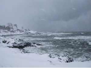
Several winter storms in early 2026 strengthened dramatically within a 24-hour period as they moved across the eastern United States, prompting renewed discussion about a process known as bombogenesis. Meteorologists say these rapidly intensifying systems can produce powerful winds, heavy snowfall, coastal flooding, and widespread travel disruptions.
According to weather reporting from Scripps News and regional affiliates, multiple systems this season met the technical threshold for what forecasters call a “bomb cyclone.” While the name sounds explosive, experts emphasize it refers to a measurable atmospheric change - not an unusual or mysterious phenomenon.
The science behind it is well established. The speed of intensification is what makes it notable.
What “Bombogenesis” Actually Means
Bombogenesis occurs when a storm’s central atmospheric pressure drops at least 24 millibars within 24 hours. That rapid pressure fall strengthens the storm’s circulation, often leading to intensifying winds and heavier precipitation.
Meteorologists explain that falling pressure acts like a tightening spring in the atmosphere. As the pressure drops, surrounding air rushes inward more forcefully, strengthening the system. The result can resemble a hurricane in structure, though these storms are driven by different temperature dynamics.
The term “bomb cyclone” describes the speed of strengthening, not necessarily the size of the storm.
Sharp Temperature Contrasts Fuel the System
One key ingredient in rapid intensification is a strong clash between cold and warm air masses. In winter, frigid continental air often meets relatively warmer, moisture-rich air over the Atlantic Ocean.
That temperature contrast creates instability. The sharper the gradient, the more energy becomes available to power storm development. Meteorologists note that the East Coast frequently provides ideal conditions for this setup during colder months.
When cold air dives southward and collides with warmer coastal air, storms can strengthen quickly offshore.
Moisture From the Ocean Adds Power
Abundant moisture is another critical factor. Storms intensify when they can draw in warm, moist air from the ocean’s surface.
As that moisture rises and condenses into clouds and precipitation, it releases heat into the atmosphere. That added heat further lowers surface pressure, accelerating the strengthening cycle. This feedback loop helps explain why some coastal storms appear to “explode” in strength.
Forecasters closely monitor sea surface temperatures, which can influence how much moisture is available to developing systems.
Jet Stream Positioning Makes or Breaks It
The jet stream - a fast-moving river of air high in the atmosphere - plays a decisive role in whether a storm intensifies or weakens. When a developing low-pressure system aligns favorably with the jet stream, rising air is enhanced.
This upper-level support effectively removes mass from the top of the storm, allowing surface pressure to fall more rapidly. Without that alignment, storms are less likely to meet bombogenesis criteria.
Meteorologists analyze jet stream patterns days in advance to anticipate potential rapid strengthening events.
Well Understood, Closely Watched
Although the phrase “bomb cyclone” can grab attention, experts stress that the process is neither rare nor unpredictable in a broad sense. Bombogenesis has been documented for decades, particularly along the U.S. East Coast and in the North Atlantic.
Forecasting models have improved significantly, allowing meteorologists to identify favorable conditions for rapid intensification earlier than in past decades. However, small shifts in temperature gradients or jet stream positioning can still affect exact storm tracks and intensity.
That uncertainty is why forecasts often evolve as storms approach land.
Why These Storms Can Feel So Severe
Rapid intensification compresses development into a shorter timeframe. Instead of gradually strengthening over several days, a storm can escalate within hours.
For communities in its path, that can mean a quick transition from routine winter precipitation to blizzard conditions or damaging winds. Coastal regions may also face higher risks of flooding due to strong onshore winds combined with low atmospheric pressure.
Meteorologists emphasize that the key hazard is not the name - but the impacts. Heavy snow, power outages, dangerous travel conditions, and coastal surge are the real concerns.
A Clearer Understanding of Extreme Winter Weather
The winter of 2026 has provided several high-profile examples of rapid storm strengthening, but experts caution against viewing these events as mysterious anomalies. The atmospheric ingredients behind bombogenesis are measurable and closely monitored.
As forecasting tools continue to improve, meteorologists aim to give communities more lead time before these systems peak. The science is complex, but the principle is straightforward: when cold air, warm ocean moisture, and upper-level winds align, storms can intensify quickly.
Understanding that process helps turn a dramatic headline into something more practical - a reminder that winter weather can change fast, and that careful monitoring remains essential.
References: What Is a Bomb Cyclone? Meteorologists Explain the Rapidly Intensifying Storms | Winter Cyclone, Virginia, and Climate Change | Bomb Cyclone: What the North Carolina Forecast Means
The Bold Fact team was assisted by generative AI technology in creating this content
Trending